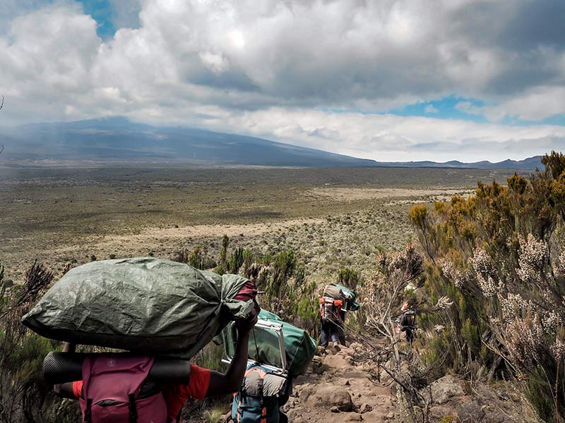
Kilimanjaro has several routes to get to the summit. They are the Shira/Londorossi Route, Lemosho, Northern Circuit, Machame, Rongai, Umbwe, and Marangu. There is also the Mweka route, which is only for descending and resupply. Of those routes, we only offer the Lemosho, Northern Circuit, Machame, and Rongai as group climbs. For Private climbs, we offer those routes plus the Marangu route.
Why only five routes?
First, let’s cover the routes we do not offer and why.
The Shira or Londorossi route
The Shira or Londorossi route has a poor success rate. The reason, you are driven almost to Shira Gate at 12,300 ft/3,749 m. This doesn’t allow your body to acclimate to the elevation. The Shira Route is the oldest route on the mountain and is now used primarily for evacuations since there is a helicopter landing pad nearby. The Lemosho route was created to “fix” the acclimatization problems caused by starting at the Shira Gate. The Lemosho route also is a trail versus the Shira route 4×4 road.
The Umbwe Route
The Umbwe Route is a rarely used route. It is very steep and only those that have something to prove attempt this route. The success rate is less than 50% and we don’t offer it due to the lack of summit success.
Other Routes
There are other routes that a few companies offer. One of them is the Spiral Route. It is listed as a new route but is really just a combination of the existing routes.
There is also the Western Breach, but it is very treacherous and requires a special permit to hike. There are many rock slides there and it is unstable. Trekkers have been killed along this route.
Finally, the Mweka route, as mentioned above is only used to descend from the summit on the Lemosho, Machame, and Northern Circuit Routes. It is also used for the porters to bring supplies to the camps above.
The Lemosho Route
The Lemosho Route is considered to be one of the prettiest routes on Kilimanjaro. You’ll start on the west side of the mountain. The first day and a half are spent hiking through the rainforest. Once above the rainforest, you’ll hike through the Heather/Moorland region and across the Shira Plateau to ascend the Shira Catherdal before circling around and heading for the summit from the South East.
8 Day Lemosho Specs:
Day 1
- 2-3 hours
- 2.9 miles
- Elevation +1,700 ft/518 m
- Start at Lemosho Gate 7,000 ft/ 2,134 m and ascend to 8,700 ft/2,650 m
- Camp: Big Tree/Lemosho Forest/Mti Mkubwa
Day 2
- 6-7 hours
- 4.9 miles
- Elevation: +3,000 ft/914 m
- Start at 8,700 ft/2,650 m and ascend to 11,600 ft/3,536 m
- Camp: Shira I
Day 3
- 4-5 hours
- 9.9 miles
- Elevation: +1,000 ft/304 m
- Start at 11,600 ft/3,536 m and ascend Shira Cathedral at 12,800 ft/3,901 m then descend back down to 12,600 ft/3,840 m
- Camp: Shira II
Day 4
- 5-7 hours
- 6.3 miles
- Elevation: +2,539 ft/774 m -2,278 ft/694 m
- Start at 12,600 ft/3840 m and ascend to Lava Tower at 15,100 ft/4,602 m then descend back down to Barranco Valley at 12,800 ft/3,901 m
- Camp: Barranco
Day 5
- 4-6 hours
- 3.2 miles
- elevation: +1,383 ft/422 m -1,096 ft/334 m
- Start at Barranco Valley at 12,800 ft/3,901 m ascend the Barranco Wall +800 ft/244 m and then continue to 13,100 ft/3,993 m
- Camp: Karanga
Day 6
- 3-5 hours
- 3.4 miles
- Elevation: +1,700 ft/518 m
- Start at Karanga Camp 13,100 ft/3,993 m ascend to 14,800 ft/4,511 m
- Camp: Barafu
Day 7
- 11-15 hours
- 10.4 miles
- Elevation: +4,500 ft /1,371 m -9,300 ft/2,835 m
- Start at Barafu Camp 14,800 ft/4,511 m ascend to the Summit 19,341 ft/5,895 m then descend to 10,000 ft/3,048 m
- Camp: Mweka
Day 8
- 4-6 hours
- 5.14 miles
- Elevation: -4,800 ft/1,463 m
- Start at Mweka Camp 10,000 ft/3,048 m descend to Mweka Gate 5,400 ft/1,646 m
- Return to hotel
The Machame Route
The Machame route is also known as the Whiskey Route. Originally the Umbwe was called the Whiskey route, but it is not regularly maintained or used for that matter so the Machame route now claims that moniker. The Machame Route is one less day than the Lemosho route and on day three joins with the Lemosho Route. It is quite steep at the bottom and is also the most popular route on the mountain. 45% of all treks are on the Machame route so it can be crowded.
7 Day Machame Specs:
Day 1
- 5-6 hours
- 6.7 miles
- Elevation +4,400 ft/1,341 m
- Start at the Machame Gate 5,718 ft/ 1,743 m and ascend to 9,930 ft/3,027 m
- Camp: Machame
Day 2
- 4-5 hours
- 3.3 miles
- Elevation: +2,800 ft/853 m
- Start at Machame Camp 9,930 ft/3,027 m and ascend to 12,600 ft/3,840 m
- Camp: Shira II (Shira Hut)
Day 3
- 5-7 hours
- 6.3 miles
- Elevation: +2,539 ft/774 m -2,278 ft/694 m
- Start at 12,600 ft/3840 m and ascend to Lava Tower at 15,100 ft/4,602 m then descend back down to Barranco Valley at 12,800 ft/3,901 m
- Camp: Barranco
Day 4
- 4-6 hours
- 3.2 miles
- elevation: +1,383 ft/422 m -1,096 ft/334 m
- Start at Barranco Valley at 12,800 ft/3,901 m ascend the Barranco Wall +800 ft/244 m and then continue to Karanga Camp 13,100 ft/3,993 m
- Camp: Karanga
Day 5
- 3-5 hours
- 3.4 miles
- Elevation: +1,700 ft/518 m
- Start at Karanga Camp 13,100 ft/3,993 m ascend to Barafu Camp 14,800 ft/4,511 m
- Camp: Barafu
Day 6
- 11-15 hours
- 10.4 miles
- Elevation: +4,500 ft /1,371 m -9,300 ft/2,835 m
- Start at Barafu Camp 14,800 ft/4,511 m ascend to the Summit 19,341 ft/5,895 m then descend to Barafu Camp 14,800 ft/4,511 m then continue down to Mweka Camp 10,000 ft/3,048 m
- Camp: Mweka
Day 7
- 4-6 hours
- 5.14 miles
- Elevation: -4,800 ft/1,463 m
- Start at Mweka Camp 10,000 ft/3,048 m descend to Mweka Gate 5,400 ft/1,646 m
- Return to hotel
The Northern Circuit Route
The Northern Circuit is a pretty route as well. It begins with the Lemosho route at the Lemosho Gate and continues the same route until you are almost to Lava Tower. From there it branches off to the North and is the only route that circles around the northern/Kenyan side of the mountain. The Route heads for the summit from the East, before rejoining the Lemosho and Machame and descending down toward the Mweka Gate. Very few people do this route because it is 9 days on the mountain, so if you have the time and like solitude, choose the Northern Circuit.
9 Day Northern Specs:
Day 1
- 2-3 hours
- 2.9 miles
- Elevation +1,700 ft/518 m
- Start at Lemosho Gate 7,000 ft/ 2,134 m and ascend to 8,700 ft/2,650 m
- Camp: Big Tree/Lemosho Forest/Mti Mkubwa
Day 2
- 6-7 hours
- 4.9 miles
- Elevation: +3,000 ft/914 m
- Start at 8,700 ft/2,650 m and ascend to 11,600 ft/3,536 m
- Camp: Shira I
Day 3
- 4-5 hours
- 9.9 miles
- Elevation: +1,000 ft/304 m
- Start at 11,600 ft/3,536 m and ascend Shira Cathedral at 12,800 ft/3,901 m then descend back down to 12,600 ft/3,840 m
- Camp: Shira II
Day 4
- 5-7 hours
- 6.3 miles
- Elevation: +2,539 ft/774 m -2,278 ft/694 m
- Start at 12,600 ft/3840 m and ascend to Lava Tower at 15,100 ft/4,602 m then descend down to 13,800 ft/4,206 m
- Camp: Moir Hut
Day 5
- 4-7 hours
- 4.4 miles
- Elevation: +1,800 ft/549 m -1,800/549 m
- Start at 13,800 ft/4,206 m ascends to 15,400 ft/4,694 m then descend to 13,600 ft/4,145 m
- Camp: Buffalo
Day 6
- 5-7 hours
- 5.1 miles
- Elevation: -800 ft/244 m
- Start at Buffalo Camp 13,600 ft/4,145 m and descend to 12,800 ft/3,901 m
- Camp: Third Cave Camp
Day 7
- 4-5 hours
- 3.0 miles
- Elevation: +2,700 ft/823 m
- Start at Third Cave Camp 12,800 ft/3,901 m ascend to 15,500 ft/4,724 m
- Camp: School Hut
Day 8
- 7-10 hours
- 7.8 miles
- Elevation: +3,845 ft/1,172 m -6,841 ft/2,085 m
- Start at School Hut 15,500 ft/4,724 m ascend to the Summit 19,341 ft/5,895 m then descend to 12,500 ft/3,810 m
- Camp: Millenium
Day 9
- 4-6 hours
- 7.6 miles
- Elevation: -7,100 ft/2,164 m
- Start at Millenium Camp 12,500 ft/3,810 m descend to Mweka Gate 5,400 ft/1,646 m
- Return to hotel
The Rongai Route
The Rongai Route starts on the remote Northeast side of the mountain. It is a good route for those who do not have the time for a longer route. Unfortunately, since it is fewer days to the summit (only five) the success rate is lowered to around 50-60%. However, it is an easier ascent to the summit since it is the most gradual. Your body won’t have to work as hard which in turn may make it easier to acclimatize. See more about acclimatizing here: https://kilimanjarosunrise.com/ways-to-prevent-altitude-sickness-on-kilimanjaro/
6 Day Rongai Specs:
Day 1
- 3-4 hours
- 4.3 miles
- Elevation +2,100 ft/640 m
- Start at Nale Moru 6,400 ft/1,950 m and ascend to 8,500 ft/2,591 m
- Camp: Rongai One Camp
Day 2
- 6-7 hours
- 5.7 miles
- Elevation: +3,300 ft/1,006 m
- Start at 8,500 ft/2,591 m and ascend to 11,800 ft/3,597 m
- Camp: Kikelewa Caves
Day 3
- 3-4 hours
- 2.3 miles
- Elevation: +2,400 ft/732 m
- Start at 11,800 ft/3,597 m and ascend to 14,200 ft/4,328 m
- Camp: Mawenzi Tarn
Day 4
- 5-6 hours
- 5.5 miles
- Elevation: 1,200 ft/366 m
- Start at Mawenzi Tarn 14,200 ft/4,328 m and descend to 15,400 ft/4,694 m
- Camp: Kibo Hut
Day 5
- 11-15 hours
- 12.3 miles
- Elevation: +3,945/1,203 m -7,145 ft/2,178 m
- Start at Kibo Hut 15,400 ft/4,694 m ascend to the Summit 19,341 ft/5,895 m then descend to 12,200 ft/3,719 m
- Camp: Horombo Hut
Day 6
- 5-6 hours
- 12.4 miles
- Elevation: -6,200 ft/1,890 m
- Start at Horombo Hut 12,200 ft/3,719 m descend to Marangu Gate 6,000 ft/183 m
- Return to hotel
The Marangu Route
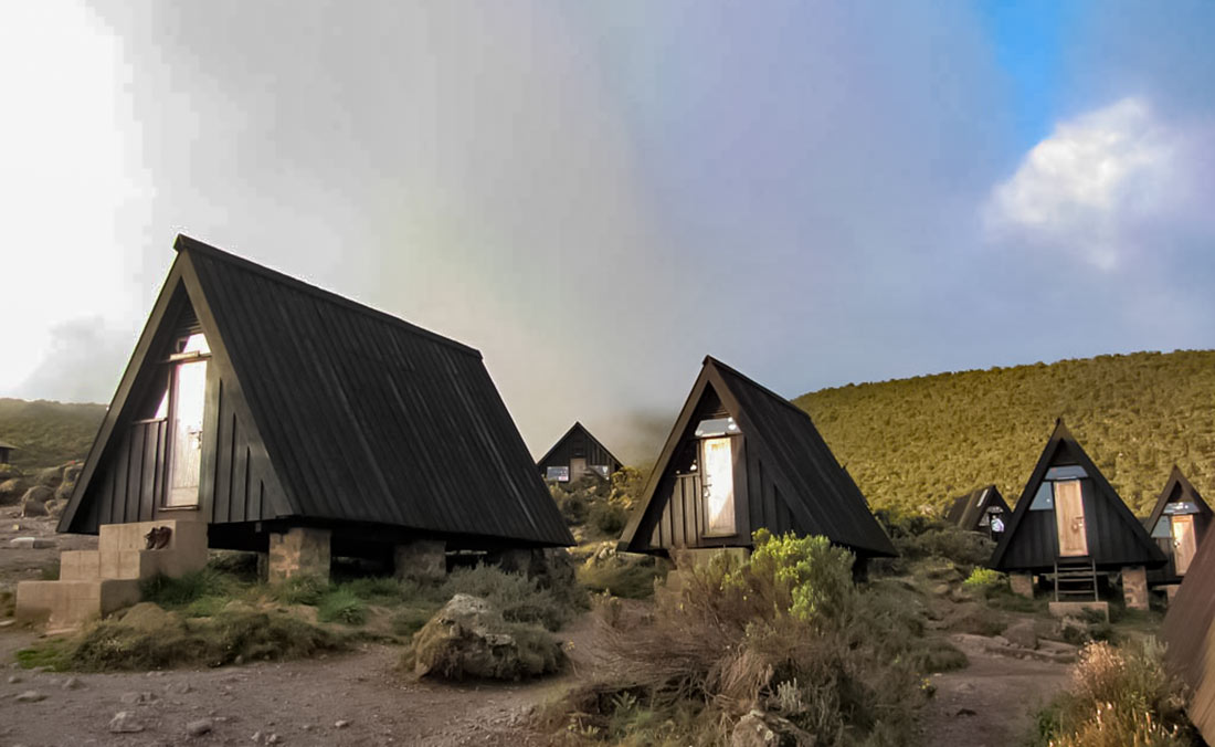
The Marangu Route is the most crowded route. The reason for this is you go up and down on the same route. This takes away from your experience since you only get to see that part of the mountain. The Marangu Route is the only route where trekkers sleep in huts. But they hold many people and therefore are noisy. This makes sleeping in them problematic. We do offer private climbs on this route, but we recommend only climbing this route during the rainy seasons (November and mid-March through May) so you don’t have to sleep on the wet ground. There are also fewer people during the two rainy seasons so it will be a better experience.
6 Day Marangu Specs:
Day 1
- 4-5 hours
- 4.3 miles
- Elevations +2,100 ft.
- Start at Marangu Gate 6,000 ft/ 1828 m and ascend to 8,800 ft/2,682 m
- Camp: Mandara Hut
Day 2
- 6-7 hours
- 5.7 miles
- Elevation: +3,400 ft/1,036 m
- Start at 8,800/2,682 m and ascend to 12,200 ft/3,718 m
- Camp: Horombo Hut
Day 3
- 3-4 hours
- 3.1miles
- Elevation: +2,200 ft/670 m
- Start at 12,200 ft/3,718 m and ascend to 14,400 ft/4,389 m
- Camp: Horombo Hut
Day 4
- 5-6 hours
- 5.5 miles
- Elevation: 1,200 ft/366 m
- Start at Mawenzi Tarn 14,200 ft/4,328 m and ascend to 15,400 ft/4,694 m
- Camp: Kibo Hut
Day 5
- 11-15 hours
- 12.3 miles
- Elevation: +3,945 ft/1,203 m -7,145 ft/2,178 m
- Start at Kibo Hut 15,400 ft/4,694 m ascend to the Summit 19,341 ft/5,895 m then descend to 12,200 ft/3,719 m
- Camp: Horombo Hut
Day 6
- 5-6 hours
- 12.4 miles
- Elevation: -6,200 ft/1,890 m
- Start at Horombo Hut 12,200 ft/3,719 m and descend to Marangu Gate 6,000 ft/183 m
- Return to hotel
We hope this helps narrow down your decision on which Kilimanjaro route to take. Whatever you choose you will be happy that you climbed with us. If you still aren’t certain what route to take feel free to email us: info@kilimanjarosunrise.com