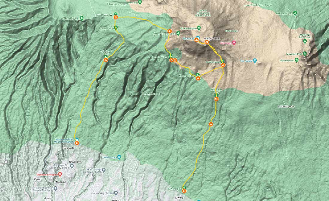
The Machame Route is one of the most popular and breathtaking routes to the summit of Mount Kilimanjaro in Tanzania. Renowned for its scenic beauty, diverse landscapes, and excellent success rates, the Machame Route offers an unforgettable adventure to those seeking to conquer Africa’s highest peak. In this article, we will delve into the key details of the Machame Route, including the distance, number of days required, and provide the GPX file for you to download and take with you.
Distance and Overview
The Machame Route covers a distance of approximately 38.5 miles (62 kilometers). It offers trekkers a challenging yet rewarding experience. The journey begins at Machame Gate, located at an altitude of 5,380 feet (1,640 meters). It gradually ascends through lush rainforests, moorlands, and alpine desert before reaching the summit at Uhuru Peak, standing tall at 19,341 feet (5,895 meters).
Number of Days
To acclimatize properly and enhance the chances of a successful summit, it is recommended to undertake the Machame Route over a span of 7 days. This duration allows for gradual altitude gain, allowing the body to adapt to the decreasing oxygen levels.
Here is a breakdown of the typical day-by-day itinerary for the Machame Route:
Day 1
Machame Gate (1,640m/5,380ft) to Machame Camp (2,850m/9,350ft)
Day 2
Machame Camp to Shira Camp (3,840m/12,600ft)
Day 3
Shira Camp to Barranco Camp (3,950m/12,960ft)
Day 4
Barranco Camp to Karanga Camp (3,995m/13,106ft)
Day 5
Karanga Camp to Barafu Camp (4,673m/15,331ft)
Day 6
Barafu Camp to Uhuru Peak (5,895m/19,341ft) and descent to Mweka Camp (3,100m/10,170ft)
Day 7
Mweka Camp to Mweka Gate (1,640m/5,380ft)
GPX File
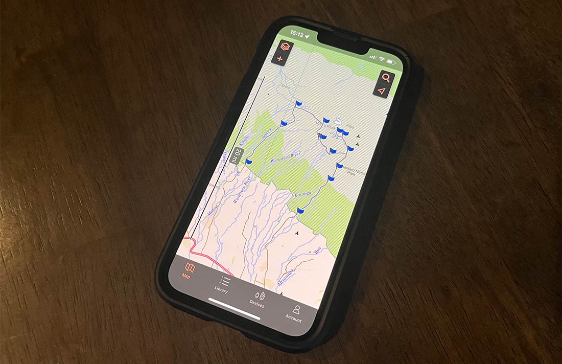
To assist trekkers in planning their adventure, we have provided a GPX overview of the Machame Route. GPX files are used to record and share GPS data, allowing trekkers to follow the route accurately. We also have it in KMZ format.
You can then upload the route to your smartphone and use an app like Gaia or Garmin Explore. They can be downloaded from the Apple Store or Google Play. You can also view your progress on a Garmin device or watch.
Final Thoughts
Embarking on the Machame Route is an awe-inspiring journey that offers trekkers the opportunity to witness stunning landscapes, diverse ecosystems, and the remarkable summit of Mount Kilimanjaro. The combination of a challenging trail, breathtaking vistas, and proper acclimatization make the Machame Route a favorite among adventurers worldwide. By understanding the distance, number of days required, and utilizing the GPX overview, trekkers can adequately prepare for this unforgettable experience, ensuring a safe and successful ascent of the magnificent Kilimanjaro.